 Summer Info


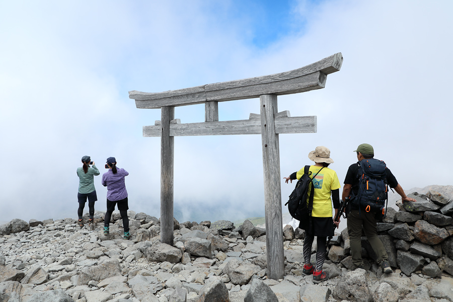
Many hikers were taking photos with the summit marker on the top of Kengamine. A strong southern wind helped cool me down after the climb up, and after recharging with a quick snack, I passed through the torii gate of the Norikura Hongu Inner Shrine (pictured). I then retraced my steps back down to Kata-no-Koya and set off toward my next destination—Fujimi-dake (elevation 2,817m).
[Mt. Norikura・Kengamine]
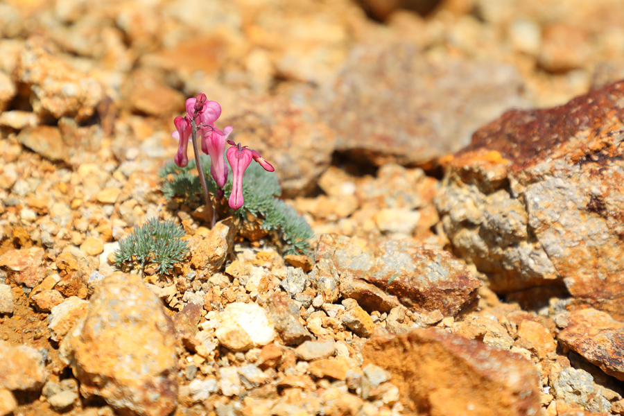
I was pleased to see that early summer alpine flowers were blooming in abundance on Mt. Norikura! Around Kata-no-Koya, fields of Hakusan ichige dotted the landscape. Along the route from the Daisekkei snowfield up to Kata-no-Koya, I saw ko-iwakagami, chinguruma, and kibana-no-shakunage rhododendrons. Near the rocky summits of Asahi-dake and Fujimi-dake, the “queen of alpine flowers”—komakusa (pictured)—was blooming in clusters here and there.
[Mt. Norikura・Fujimi-dake]
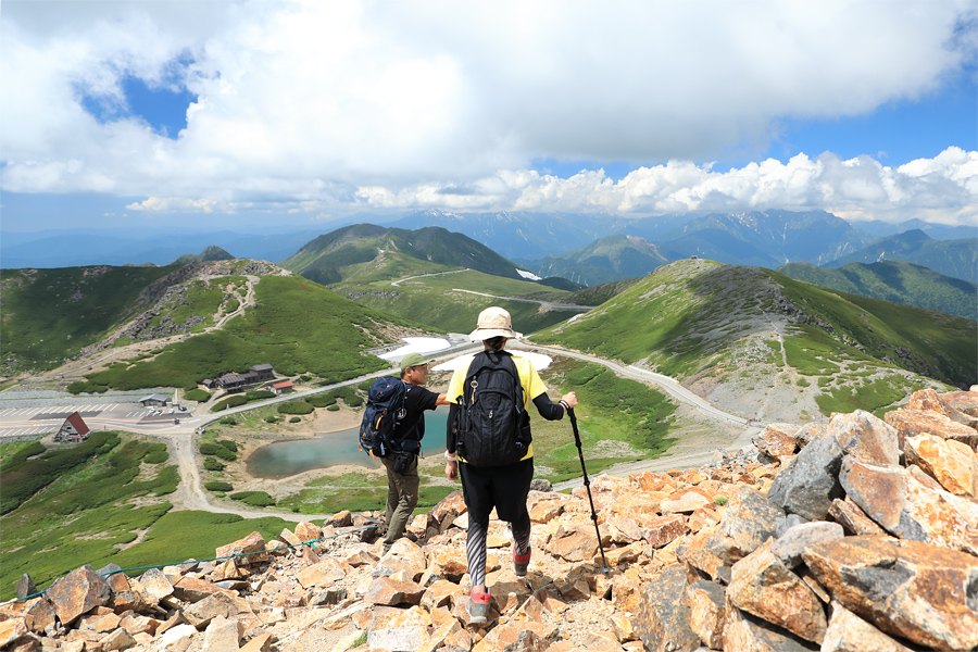
The descent from the summit of Kengamine to Kata-no-Koya took about 50 minutes. After a short break, I took an easy, gentle trail from Kata-no-Koya and reached the summit of Fujimi-dake in about 20 minutes. Tatamidaira, the final stop of the Norikura Summit Shuttle Bus, is Japan’s highest-elevation bus terminal at 2,702 meters (pictured, left).
[Mt. Norikura・Fujimi-dake]
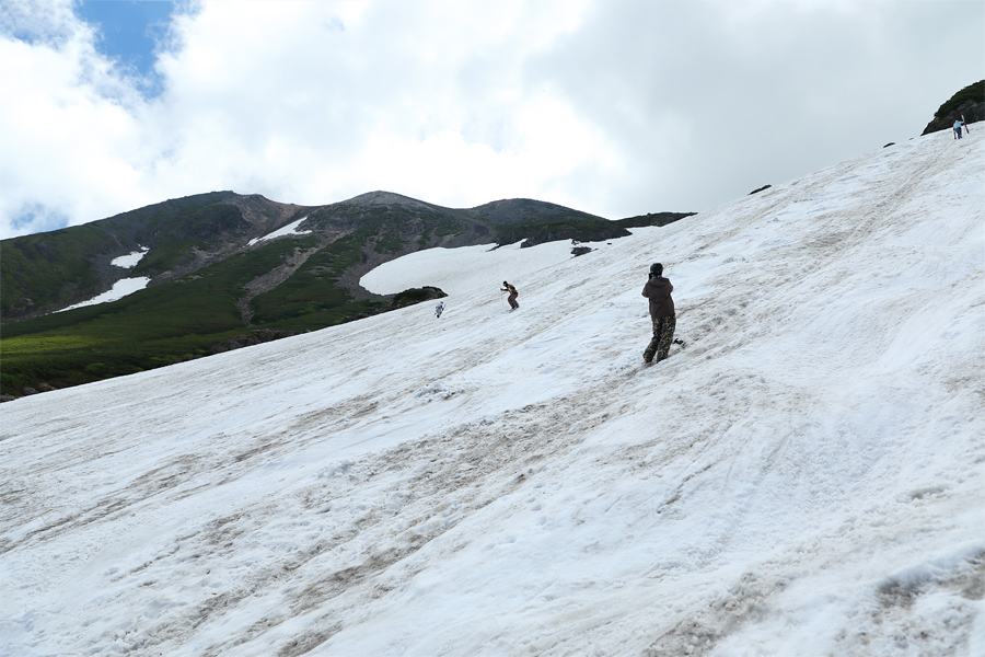
Near the lower section of the Daisekkei (pictured), skiers and snowboarders were repeatedly hiking up and carving down a roughly 100-meter-long mogul slope. One of the skiers I rode the bus with to and from told me, “I always check your site! I never thought I’d meet someone from Snownavi here. We keep shaping the moguls ourselves and ski here until around mid-August.”
[Mt. Norikura・Daisekkei]
[Mt. Norikura]
*Location … Matsumoto City, Nagano Prefecture; Takayama City, Gifu Prefecture
*Trailhead … Kata-no-koyaguchi
*Please be sure to submit a mountain entry report when entering the mountain
*Equipment … backpack, rain gear, down jacket, towel, change of clothes, sack cover, water and food, medicine, gloves, sunglasses, sunscreen, cell phone, etc.